.png)
Rock Dunder Nature Reserve
Opens May 15th!
Contact Us: 1-343-251-1013 or info@rwlt.org
Rock Dunder is open on May 15th, 2024, until November 15, 2024.
Find us with our Plus Code: GQJX+RJ Lyndhurst, Ontario or our GPS coordinates: 44.5320439,-76.2036029

Tickets:
Day Passes: Purchase Here
Season Passes: Purchase Here
Passes will also be sold at the Rock Dunder trailhead.
-
Day Pass per hiker:
$6.00 per hiker
-
Family Group Pass (2 adults + 2 or more children):
$20.00
-
School Group Pass (18 and under): $75.00
-
2024 Season passes can be purchased here for $60 each
About Rock Dunder:
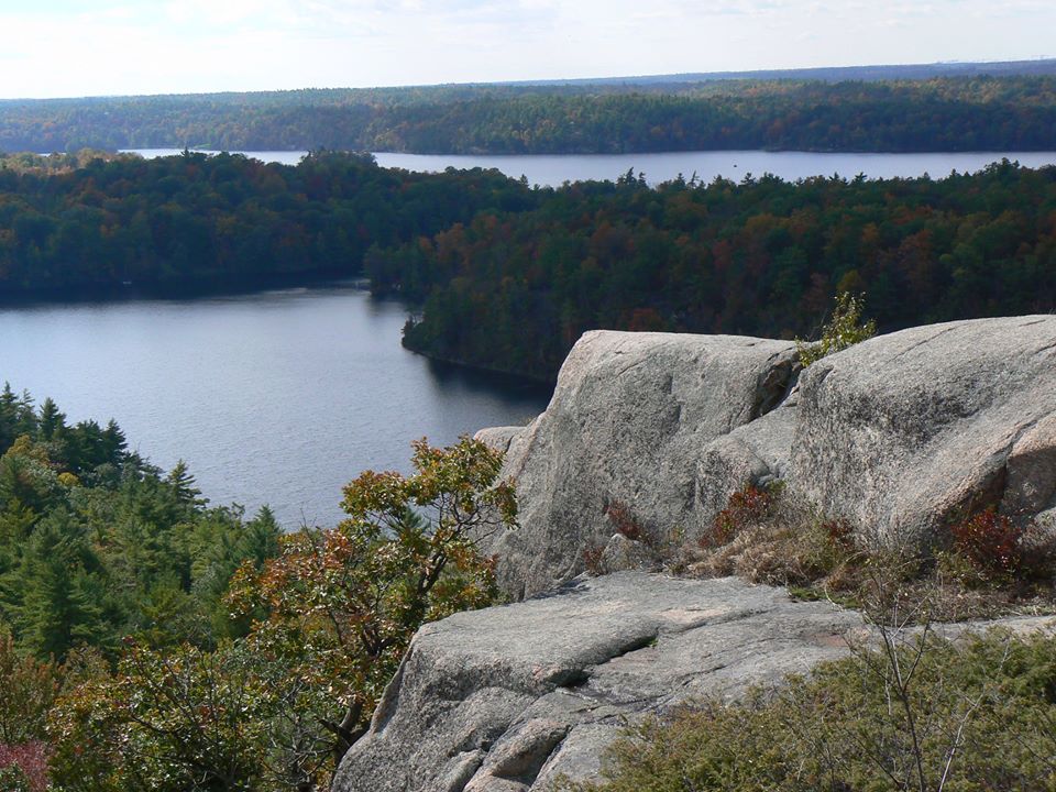
- Rock Dunder is a treasure that lies within the UNESCO Thousand Islands Frontenac Arch Biosphere Reserve. Rising 275 feet above Morton Bay, Rock Dunder provides breathtaking views of the surrounding lakes and woodlands. Trails lead to one of the highest points of land in the area, and offer stunning vistas that are enjoyed seasonally by local residents and visitors to the area. For many, childhood memories of hiking trips to Rock Dunder remain fresh in their minds.
- Rideau Waterway Land Trust members and supporters raised funds to purchase Rock Dunder in 2006. Scouts Canada decided to sell Rock Dunder, after using the site wilderness camp for almost 40 years, and to use the funds used to upgrade other camps better suited to younger campers.
- RWLT’s acquisition of Rock Dunder ensures this significant property remains undeveloped.
- Open for hiking from sunrise to sunset, May 15 - Nov 15
- Purchase your pass ahead of time online or at the gate when you arrive.
-
To review the Property Management Plan for Rock Dunder, click HERE.
Trails:
- The 3 trails include the Morton Bay Loop and the Summit Loop and the Cabin Trail.
- The Morton Bay Loop comprises two moderately steep sections to and from a small peninsular outlook over Morton Bay. The hike is 2km through mixed forest.
- The Summit Loop is a 3.9km climb which runs alongside Dean's Island through a variety of forest, offering sneak peaks over rocky cliffs. The summit offers a panoramic view of the Rideau Waterway.
- The Scout Cabin Trail is 1.55km
Rock Dunder Location:
- 72 Stanley Lash Ln, Morton ON
- Find us with our Plus Code: GQJX+RJ Lyndhurst, Ontario or our GPS coordinates: 44.5320439,-76.2036029
- Located at the portage leading to the Gananoque River system and down through the heart of the UN Biosphere, Rock Dunder provides a natural rest for canoeists traveling the Rideau Waterway.
- Rock Dunder is located just south of Morton. Take Stanley Lash Lane west of Highway 15, and go 1200 metres to the parking lot and trail head.
- Visitors need to be mindful of traffic when walking along the highway shoulder towards the Rock Dunder entrance off Stanley Lash Lane.
- Rideau Waterway Land Trust staff and volunteers have been making improvements to the trails at Rock Dunder. The two log cabins are off limits to hikers.
Parking:
- RWLT does not control arrival and departure times of visitors. A supporter pass does not guarantee a parking place. When on-site parking at Rock Dunder is full, visitors should use off-site parking to the north. There are No Parking areas signed on the shoulder of Highway 15 near Stanley Lash Lane. Cars parked illegally may ticketed or towed: the OPP enforces the No Parking areas.