.png)
Northern Map Turtle (Graptemys geographica)
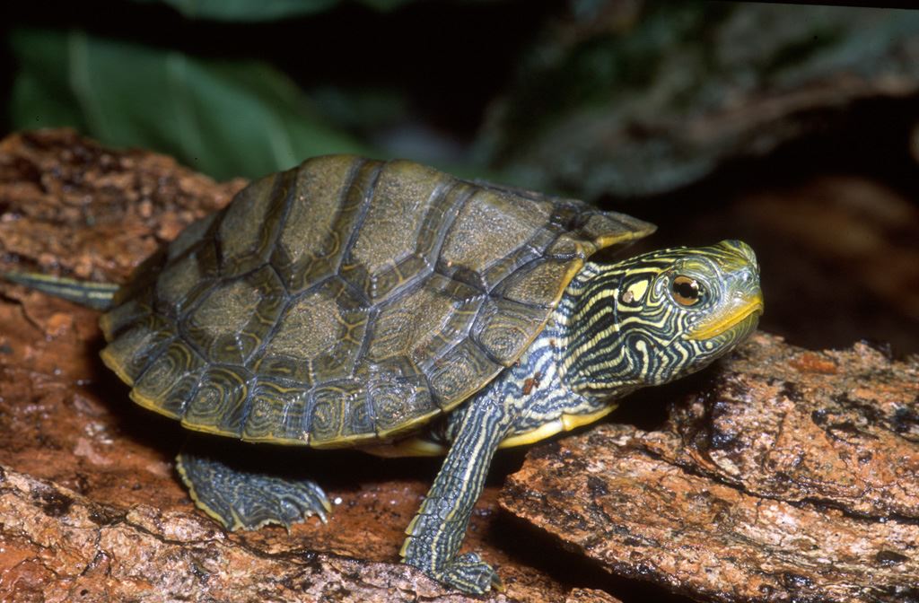
© 2009 James H. Harding
What does it look like?
The Northern Map Turtle gets its name from the lines on the upper shell, or carapace, that resemble contour lines on a map. The lines on the carapace are shades of yellow, tan, or orange and are surrounded by dark borders. The rest of the carapace is olive green or greyish brown. The lower shell, or plastron, is light yellow to cream. There is a yellow spot behind the eyes, and both the head and legs have an intricate pattern of bright yellow lines.
Where does it live?
The Northern Map Turtle inhabits rivers and lakeshores where it basks on emergent rocks and fallen trees throughout the spring and summer. In winter, the turtles hibernate on the bottom of deep, slow-moving sections of river. They require high-quality water that supports the female’s mollusc prey. Their habitat must contain suitable basking sites, such as rocks and deadheads, with an unobstructed view from which a turtle can drop immediately into the water if startled.
What threatens it?
Habitat loss and degradation due to shoreline development and decline in water quality threaten the Northern Map Turtle in Ontario. The spread of invasive species such as Zebra Mussels also poses a potential threat to this species. It is also vulnerable to mortality on roadways and injury from boat propellers. Additionally pet trade may be contributing to declines of this species in the USA and Canada. This turtle resembles several popular pet trade species, and illegal capture and export may be taking place.
Where else has it been found?
In Canada, this turtle it is found in southwestern Quebec and southern Ontario. In southern Ontario, it lives primarily on the shores of Georgian Bay, Lake St. Clair, Lake Erie and Lake Ontario, and along larger rivers including the Thames, Grand and Ottawa.